1800 490 514 [email protected]

Civil 3D Vs Infraworks – Workflows and Differences

Learn about the key differences and workflows in Civil 3D vs Infraworks

Civil 3D Vs Infraworks - Workflows and Differences

Civil 3D and Infraworks are two of the most popular civil engineering design software programs on the market. They offer a wide range of features and capabilities that can help civil engineers to design, analyze, and visualize infrastructure projects. However, there are some key differences between the two programs that can affect the best workflow for a particular project.

In this blog post, we will compare and contrast Civil 3D and Infraworks in terms of their features, capabilities, workflows, and pricing. We will also discuss the SEO keywords that are relevant to this topic.

Features and Capabilities

Civil 3D is a powerful CAD software program that offers a wide range of features for civil engineering design. It includes tools for 2D and 3D drafting, surface modeling, land development, pipe networks, storm drainage, and much more. Civil 3D also integrates with other Autodesk products, such as AutoCAD and Autodesk Map 3D, to provide a comprehensive civil engineering design solution.

Infraworks is a conceptual design software program that is designed to help civil engineers to visualize infrastructure projects in the context of their surroundings. It includes tools for creating 3D models of terrain, buildings, and other infrastructure elements. Infraworks also allows users to simulate the impact of different design decisions on the environment and traffic flow.

Workflows between Civil 3D and Infraworks

Civil 3D and Infraworks can be used in a variety of workflows, depending on the specific needs of the project. However, there are some general differences in the way that the two programs are typically used.

Civil 3D is often used for detailed design and documentation of infrastructure projects. It is a good choice for projects that require precise measurements and calculations. Civil 3D can also be used for construction staking and as-built documentation.

Infraworks is often used for conceptual design and planning of infrastructure projects. It is a good choice for projects that require a high level of visualization and collaboration. Infraworks can also be used to create preliminary cost estimates and to identify potential environmental impacts.
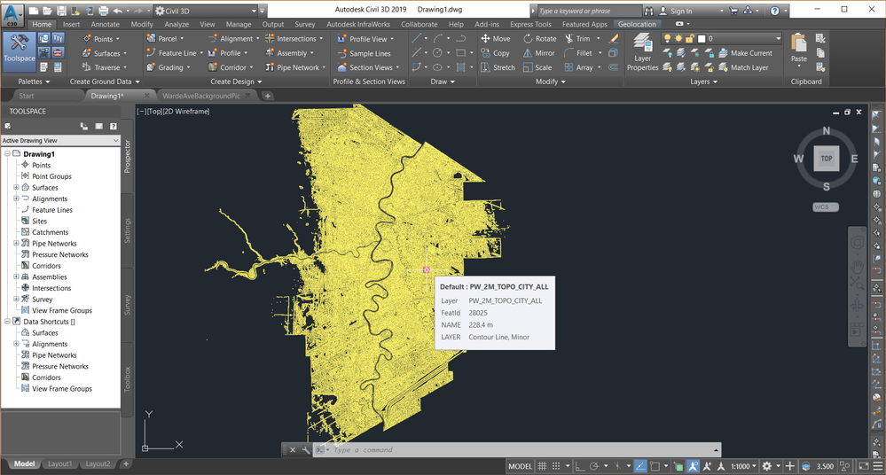
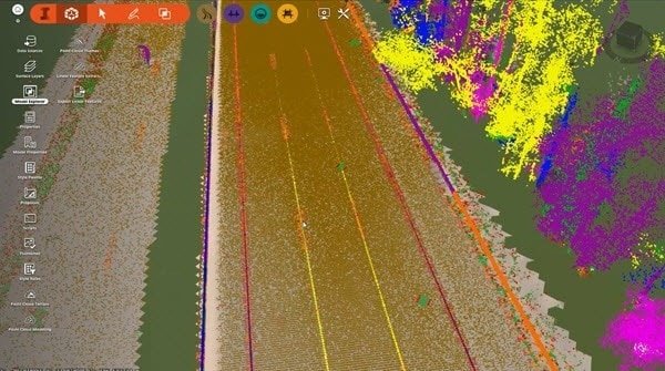
Autodesk Civil 3D Lidar imaging capabilities

Here is a table that summarizes the key differences between Civil 3D and Infraworks:

2D and 3D draftingYesYes
Surface modelingYesYes
Land developmentYesYes
Pipe networksYesYes
Storm drainageYesYes
Traffic modelingYesNo
Environmental impact analysisNoYes
VisualizationYesYes
CollaborationYesYes
Cost estimationYesNo
As-built documentationYesNo

As you can see, Civil 3D and Infraworks have a lot of overlap in terms of the commands and features that they offer. However, there are also some key differences between the two programs.

Civil 3D is better suited for detailed design and documentation of infrastructure projects. It offers a wider range of features and capabilities for these tasks, such as traffic modeling and cost estimation.

Infraworks is better suited for conceptual design and planning of infrastructure projects. It is designed to help civil engineers to visualize infrastructure projects in the context of their surroundings. It also offers features for environmental impact analysis and collaboration.

The best program for a particular project will depend on the specific needs of the project. If you are looking for a program that offers a wide range of features and capabilities for detailed design and documentation, then Civil 3D is a good choice. If you are looking for a program that is designed for conceptual design and planning, then Infraworks is a good choice.
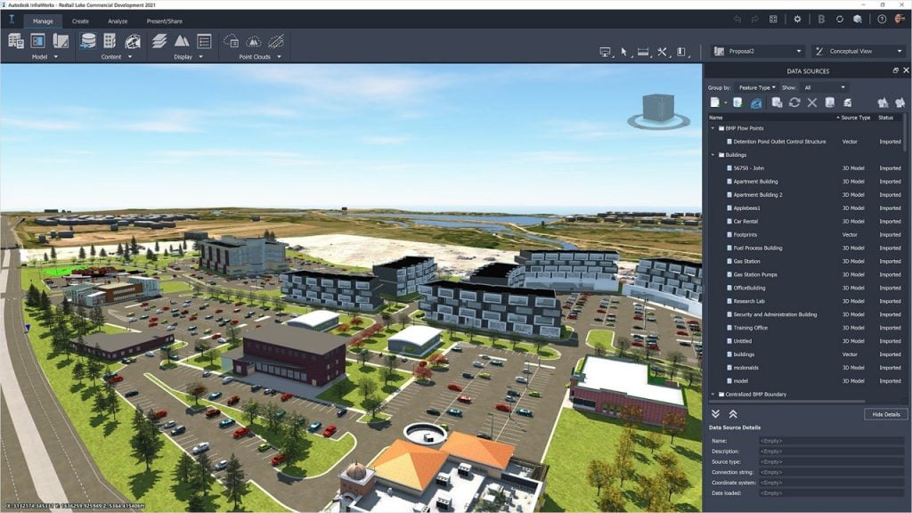
Design Consulting Infraworks Moving at the Speed of Business
FeatureCivil 3DInfraworks
PurposeDetailed design and documentationConceptual design and planning
FeaturesWider range of features and capabilitiesMore focused on visualization and collaboration
CostMore expensiveLess expensive
Best forProjects that require precise measurements and calculationsProjects that require a high level of visualization and collaboration

Working between Civil 3D and Infraworks

You can import and export data between Civil 3D and Infraworks in a few different ways:

  • Import an Infraworks model into Civil 3D. To do this, open Civil 3D and click on the Insert tab. In the InfraWorks panel, click Open InfraWorks Model. In the Open InfraWorks Model dialog box, browse to the location of the Infraworks model that you want to import and click Open.
  • Export a Civil 3D drawing to Infraworks. To do this, open Civil 3D and click on the Export tab. In the Export panel, click InfraWorks. In the Export to InfraWorks dialog box, browse to the location where you want to save the Infraworks file and click Save.
  • Link a Civil 3D drawing to an Infraworks model. To do this, open Civil 3D and click on the Data Sources tab. In the Data Sources panel, click Add. In the Add Data Source dialog box, select the InfraWorks DWG option and click Next. In the Select InfraWorks DWG dialog box, browse to the location of the Infraworks DWG file that you want to link to and click Open.

The specific steps for importing, exporting, and linking data between Civil 3D and Infraworks may vary depending on the specific version of the software that you are using. For more detailed instructions, please refer to the documentation for Civil 3D and Infraworks.

Here are some additional tips for importing, exporting, and linking data between Civil 3D and Infraworks:

  • When importing an Infraworks model into Civil 3D, you can choose to import the entire model or a specific selection of objects.
  • When exporting a Civil 3D drawing to Infraworks, you can choose to export the entire drawing or a specific selection of objects.
  • When linking a Civil 3D drawing to an Infraworks model, you can choose to link the entire drawing or a specific selection of objects.
  • It is important to make sure that the coordinate systems of the Civil 3D drawing and the Infraworks model are the same. If the coordinate systems are not the same, you may experience problems when importing, exporting, or linking data between the two programs.
  • It is also important to make sure that the versions of Civil 3D and Infraworks that you are using are compatible. If the versions are not compatible, you may experience problems when importing, exporting, or linking data between the two programs.

Which Program should I Use and When?

You can import and export data between Civil 3D and Infraworks in a few different ways:

  • Import an Infraworks model into Civil 3D. To do this, open Civil 3D and click on the Insert tab. In the InfraWorks panel, click Open InfraWorks Model. In the Open InfraWorks Model dialog box, browse to the location of the Infraworks model that you want to import and click Open.
  • Export a Civil 3D drawing to Infraworks. To do this, open Civil 3D and click on the Export tab. In the Export panel, click InfraWorks. In the Export to InfraWorks dialog box, browse to the location where you want to save the Infraworks file and click Save.
  • Link a Civil 3D drawing to an Infraworks model. To do this, open Civil 3D and click on the Data Sources tab. In the Data Sources panel, click Add. In the Add Data Source dialog box, select the InfraWorks DWG option and click Next. In the Select InfraWorks DWG dialog box, browse to the location of the Infraworks DWG file that you want to link to and click Open.

The specific steps for importing, exporting, and linking data between Civil 3D and Infraworks may vary depending on the specific version of the software that you are using. For more detailed instructions, please refer to the documentation for Civil 3D and Infraworks.

Here are some additional tips for importing, exporting, and linking data between Civil 3D and Infraworks:

  • When importing an Infraworks model into Civil 3D, you can choose to import the entire model or a specific selection of objects.
  • When exporting a Civil 3D drawing to Infraworks, you can choose to export the entire drawing or a specific selection of objects.
  • When linking a Civil 3D drawing to an Infraworks model, you can choose to link the entire drawing or a specific selection of objects.
  • It is important to make sure that the coordinate systems of the Civil 3D drawing and the Infraworks model are the same. If the coordinate systems are not the same, you may experience problems when importing, exporting, or linking data between the two programs.
  • It is also important to make sure that the versions of Civil 3D and Infraworks that you are using are compatible. If the versions are not compatible, you may experience problems when importing, exporting, or linking data between the two programs.

Civil 3D and Infraworks Use Cases

Here are some applications when a Civil 3D user should use Infraworks:

  • Conceptual design: Infraworks is a great tool for conceptual design because it allows you to visualize infrastructure projects in the context of their surroundings. This can help you to identify potential problems and to make better design decisions.
  • Planning: Infraworks can also be used for planning infrastructure projects. It allows you to simulate the impact of different design decisions on the environment and traffic flow. This can help you to choose the best design for the project.
  • Collaboration: Infraworks is a great tool for collaboration because it allows you to share 3D models of infrastructure projects with other team members. This can help to improve communication and to ensure that everyone is on the same page.

Here are some applications when an Infraworks user should use Civil 3D:

  • Detailed design: Civil 3D is the best tool for detailed design because it offers a wider range of features and capabilities than Infraworks. This includes features for traffic modeling, cost estimation, and as-built documentation.
  • Documentation: Civil 3D is also a good tool for documentation because it allows you to create 2D and 3D drawings of infrastructure projects. These drawings can be used to communicate the design to stakeholders and to construct the project.
  • Simulation: Civil 3D can also be used for simulation. It allows you to simulate the behavior of infrastructure projects under different conditions. This can help to identify potential problems and to improve the design of the project.
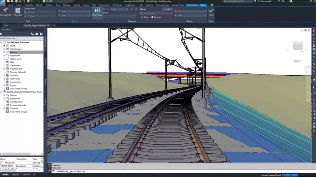
Autodesk Civil 3D railroad design

Civil 3D Vs Infraworks Conclusion

Civil 3D and Infraworks are two powerful software programs that can be used for a variety of civil engineering design tasks. The best program for a particular project will depend on the specific needs of the project.

If you are looking for a program that offers a wide range of features and capabilities for detailed design and documentation, then Civil 3D is a good choice. If you are looking for a program that is designed for conceptual design and planning, then Infraworks is a good choice.

No matter which program you choose, it is important to make sure that you are familiar with the features and capabilities of the program before you start using it. This will help you to avoid any problems and to get the most out of the program.

Need Software, Training, Setup or Consulting?

If you have any requirements or want to learn more, feel free to contact us on 1800 490 514, email [email protected] or by filling out the form below

Standard Contact Form

Keywords: Civil 3D, infraworks, Civil 3D vs infraworks, Civil engineering design software, Civil engineering, Conceptual design software, Infrastructure design,  civil 3D modeling

VIEW MORE

Autodesk Infraworks

Autodesk infraworks and Autodesk infraworks training courses from Design Consulting
InfraWorks® conceptual design software lets architecture, engineering and construction professionals model, analyse and visualise infrastructure design concepts within the context of the built and natural environment – improving decision making and accelerating project approvals.

InfraWorks conceptual design software lets architecture, engineering and construction professionals model, analyse and visualise infrastructure design concepts within the context of the built and natural environment – improving decision making and accelerating project approvals.

Autodesk Infraworks Solutions Overview

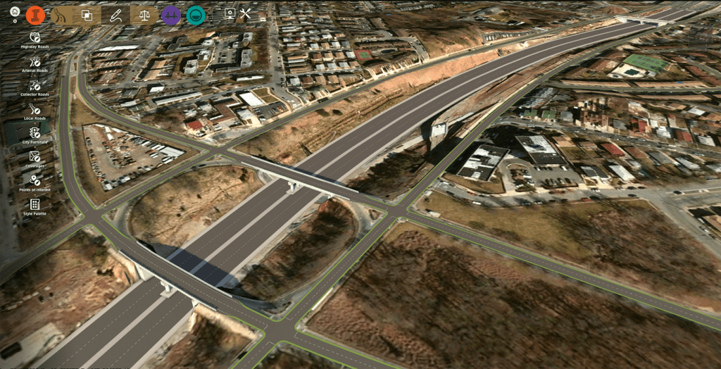
Autodesk InfraWorks is Infrastructure design software that lets architecture, civil engineering and construction professionals model, analyse and visualise infrastructure design concepts within the context of the built and natural environment – improving decision making and accelerating project approvals with traffic and mobility simulation and context modeling. 

Create a real-world context model

  • Aggregate large amounts of data to generate a rich context model.
  • Seamlessly integrate design with geospatial GIS data.
  • Model existing conditions that represent the built and natural environment.

Optimise designs and communicate with immersive visualisations

  • Visually explore conceptual design options in context.
  • Use analysis and simulation tools to explore important aspects of your project.
  • Generate compelling and immersive visual experiences to communicate design intent.

CONCEPTUAL DESIGN FEATURES

Theme Palettes

Visually classify assets according to attributes.

Cross-section views

Assess superelevation, road assembly, and cut-and-fill engineering details of your road design in cross-section form.

Component roads

Design roads with curbs, lanes, shoulders. Create parametric models in Inventor and add them to the component road design.

Roadside grading

Vary the slopes and the materials applied to different sections of roadside grading.

Roundabout design

Easily convert an intersection into a roundabout style.

Component-based bridge design

Edit bridge decks and girders independently of other bridge components.

NEW FEATURES

See what’s new in Autodesk InfraWorks

Full span complex 3D girders

Create complex 3D models of full span bridge girders that meet your project requirements and LOD.

Active linear road decorations

Apply or edit decorations to component roads without model regeneration to speed design processes. 

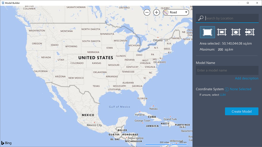
Model Builder UI enhancements

Streamlined interface for more consistent user experience across tools.

CONTEXT MODELING

Autodesk InfraWorks Features

Autodesk Connector for ArcGIS

Add ArcGIS content to InfraWorks models, create custom stylization, and use field applications.

View projects in context

View projects in context of existing conditions.

Generate features from point clouds

Generate features from point clouds

Extract linear features from point clouds. Export linear features, vertical features, and ground grid to Civil 3D.

Model existing environment

Create a large-scale model by aggregating existing data including 2D CAD, GIS, raster, and 3D models.

Generate terrain from point clouds

Generate terrain from point clouds

Build data into your model terrain.

Automated data import and model creation

Create base models from GIS, Raster, DGN, and SketchUp.

ANALYSIS AND SIMULATION

InfraWorks features

Flood simulation

Flood Simulation

Analyze flooding projects based on multiple inflow locations and water elevation changes over time.

2D distance and slope

Measure the distance (horizontal and vertical) and slope between two points in a model.

Traffic simulation

Analyze traffic flow, display traffic analysis results, and generate traffic simulation animations.

Material quantities

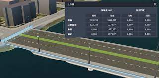
Calculate earthwork quantities on multiple selected roads, a station range, area of interest parcel, or right of way.

Mobility simulation

Create animated simulations of transit, parking, personal, and/or taxi-mode modeling. 

Bridge line girder analysis

Perform a detailed analysis in the cloud.

VISUALISATION

InfraWorks features

Photorealistic visuals

Create realistic images and videos that helps improve understanding of how your project will perform. 

Storyboarding and animations

Create presentations that include snapshot views, animations, perspective views, and fly-throughs.

PREVIOUS RELEASE FEATURES

See all InfraWorks features

Refined bridge analysis

Take bridge design beyond preliminary stages with grillage and finite element analysis.

Native LAS/LAZ format support

Import both LAS and LAZ point cloud data formats natively into InfraWorks.

Connector for ArcGIS

Select specific attributes when exporting a file geodatabase and publishing information to ArcGIS Online.

Model Builder UI

Model Builder

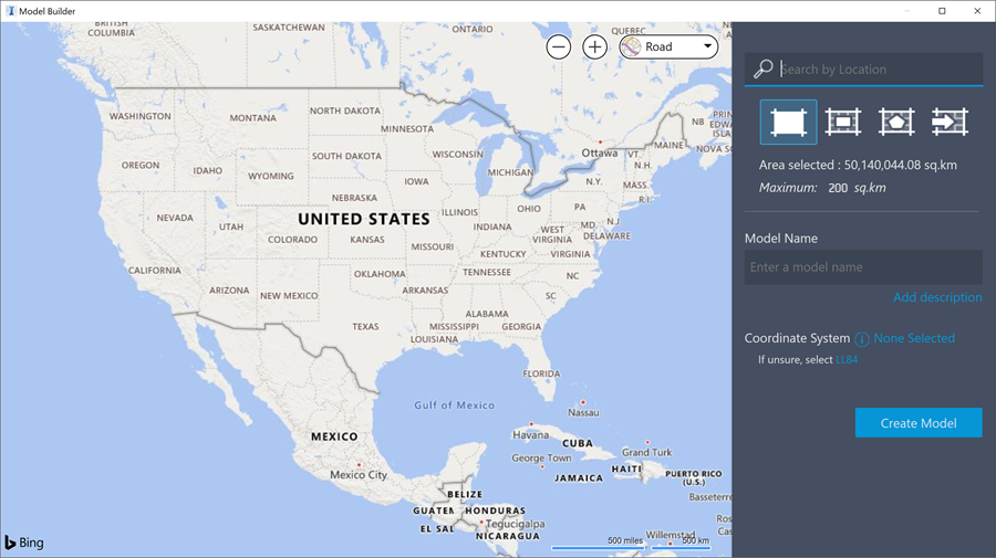
Experience a more cohesive Model Builder user interface with InfraWorks (2020.2) and later versions.

Road cross-section view

You can make better design decisions, thanks to the ability to view distinct surface layers in a cross section, such as soil layers.

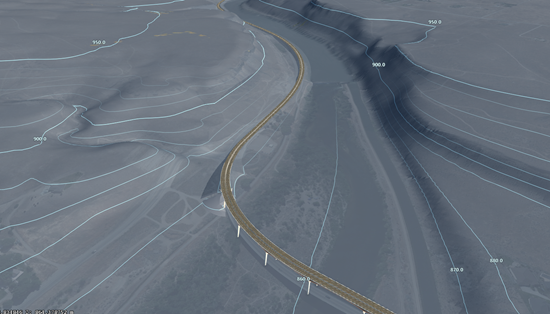
Terrain contour views

Terrain Contour Views

Control terrain contours presentations through enhanced view settings.

Point clouds

Point Clouds

Use photos to assist you when modeling features based on point cloud data.

Precision edits for profiles

Precision Edits

Modify geometric values of a selected vertical curve in the Curve Properties panel in profile view.

Home page UI enhancements

Homepage

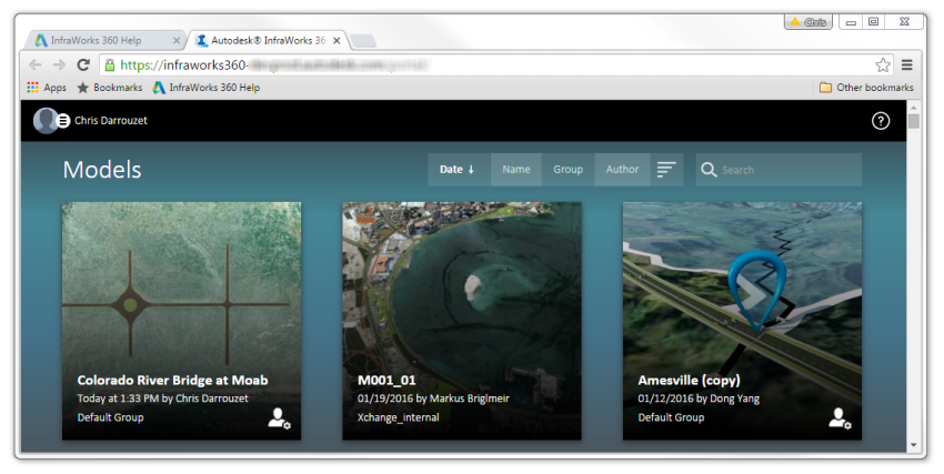
Quickly access data with a centralized home page UI that is easier to use and incorporates BIM 360 projects.

Increased cross frame LOD

Reduce time needed to model complex components with automatic modeling of cross frames and diaphragms.

Bridge design

Rapidly develop multiple design options with powerful parametric modeling and automated documentation.

Support for complex bridges

New bridge bearings feature with customizable parametric capability supports complex bridge types.

Extend schema transfer between features

Extended Schema

Add new types of features to your model and additional properties onto existing features for more aggregated models with deeper metadata.

Delayed model regeneration

Delayed Regeneration

Speed up editing workflows by delaying automatic model regeneration for road centerline modification.

Parametric tunnels

Tunnel Design

Model and design parametric tunnels in the context of your overall infrastructure design project.

Quantities

Quantities

Calculate underground infrastructure quantities by depth.

Terrain enhancements

Terrain

Create separate terrain surfaces and multiple types of subsurface layers, such as rock and subsoil, to use as a basis for design.

4K view

2021 Splash Screen After Moving at the Speed of Business

Use high DPI scaling optimized for 4K viewing of the InfraWorks interface.

Component road enhancements

Effectively validate corridor parameters and adjust lane component styles to meet design standards.

Corridor modeling

Use the power and precision of Civil 3D for corridor models in Infraworks.

Road grading cut/fill material

Control the color of cut and fill areas in a road design to visibly show changes to terrain by a road. 

Profile view

Profile View

Explore the new dynamic capabilities to edit and revise the components of your profile.

Shared views

Infraworks Viewer

Share asset properties and bookmarked web views of your models to enhance collaboration.

Road layout

Road Layout

Choose between element-based or PI-based layout for more flexibility in how you design roads.

Easy management of models

Model Management

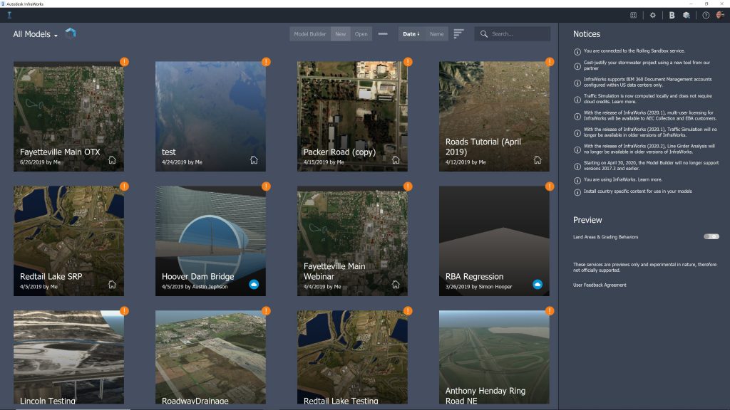
Seamlessly manage models in InfraWorks Home. View model states in context. Open, duplicate, store, or remove local models.

Model Builder CS update

Model Builder

Select projected coordinate systems in InfraWorks models to be used in cross-product workflows.

WORKFLOWS

Use InfraWorks with other Autodesk software.

InfraWorks + Civil 3D + ReCap Pro + more

Establish existing site conditions and extract linear features to accelerate design 

InfraWorks + Civil 3D + ReCap Pro + more

Generate a real-world context model that can be used in detailed design

InfraWorks + Civil 3D + Revit

Integrated bridge analysis and design

CUSTOMER STORIES

See how people are using InfraWorks

BRAZILIAN ARMY
The Brazilian Army gives the 100-year-old underground sewage network in Rio de Janeiro’s Military District a much-needed face lift.
OBG-RAMBOLL
OBG-Ramboll turned to the integration of BIM and GIS along with tools like Revit and InfraWorks to improve outcomes in a superfund site project.
EGIS JMI
A novel approach made it possible to design and construct the complex geometry behind Africa's longest and tallest cable-stayed bridge.
CARDNO
Rich InfraWorks models enable Cardno to generate immersive visualizations that help stakeholders better understand the impact of their projects.
Previous slide
Next slide

Pricing

Buy InfraWorks on an Annual Subscription or 3 Year Subscription. Get more value from the Media and Entertainment Collection. 

Contact Us

If you would learn more about Autodesk software, please contact us by calling on 1800 490 514, by filling out the form or clicking the live chat in the bottom right-hand corner.

Contact Us Moving at the Speed of Business

VIEW MORE

AutoCAD Vs Civil 3D Showdown

AutoCAD and Civil 3D are both powerful CAD software programs, but they have different strengths and weaknesses. This blog post will compare and contrast the two programs, so you can decide which one is right for your needs.

AutoCAD Vs Civil 3D Showdown

AutoCAD and Civil 3D are two of the most popular CAD software programs on the market. AutoCAD is a general-purpose CAD program that can be used for a wide variety of tasks, while Civil 3D is a specialised CAD program designed for civil engineering applications.

In this blog post, we will compare and contrast AutoCAD and Civil 3D. We will discuss their strengths and weaknesses, and we will help you decide which program is right for your needs.

Features

AutoCAD:

  • 2D and 3D drafting
  • Object-based drawing
  • Advanced editing tools
  • Dimensioning and annotation
  • Rendering and visualization
  • Data management
  • Collaboration tools

Civil 3D:

  • Civil engineering-specific tools
  • Alignments
  • Profiles
  • Corridors
  • Pipe networks
  • Land development
  • Surveying
  • Rendering and visualization
  • Data management
  • Collaboration tools

Piping and Drainage

Civil 3D has a number of features that make it well-suited for piping and drainage design. For example, Civil 3D has a tool that can be used to automatically create pipe networks, and it has a tool that can be used to analyze the hydraulics of pipe networks.

Corridor modelling

A powerful tool in Civil 3D that can be used to create 3D models of roads, highways, railways, and other linear features. Corridor models are created by placing 2D sections (assemblies) at incremental locations along a baseline. The assemblies are then joined together to create a continuous 3D model.

Corridor modelling has a number of advantages over traditional 2D drafting methods. First, corridor models are more accurate because they take into account the vertical as well as the horizontal dimensions of the feature being modeled. Second, corridor models are more flexible because they can be easily modified to accommodate changes in the design. Third, corridor models are more efficient because they can be used to generate a variety of output, such as cross-sections, profiles, and surfaces.

Strengths and Weaknesses

Strengths of AutoCAD:

  • More general-purpose
  • Easier to learn
  • More affordable
  • Larger user community

Strengths of Civil 3D:

  • More specialised features
  • More powerful tools
  • Better integration with other Autodesk products
  • More comprehensive documentation

Weaknesses of AutoCAD:

  • Not as specialised as Civil 3D
  • Can be difficult to learn for civil engineers
  • Not as powerful as Civil 3D
  • Lacks some of the civil engineering-specific features of Civil 3D

Weaknesses of Civil 3D:

  • More expensive than AutoCAD
  • More difficult to learn
  • Smaller user community
Autodesk Civil 3D grading optimisation. AutoCAD vs Civil 3D

Survey Surfacing

Civil 3D has a number of features that make it well-suited for survey surfacing. For example, Civil 3D has a tool that can be used to import survey data, and it has a tool that can be used to create 3D surfaces from survey data.

Surfacing and Parcels

Civil 3D has a number of features that make it well-suited for surfacing and parcels. For example, Civil 3D has a tool that can be used to create TIN surfaces, and it has a tool that can be used to create parcels.

Drawing Production

Both AutoCAD and Civil 3D can be used for drawing production. However, Civil 3D has a number of features that make it better suited for this task. For example, Civil 3D has a number of tools that make it easier to create and manage drawing layers, and it has a built-in drawing template that can be used to create consistent drawings.

AutoCAD Vs Civil 3D Conclusion

The best CAD software program for you will depend on your specific needs. If you are a civil engineer, then Civil 3D is the better choice. It has the specialized features and tools you need to create accurate and detailed civil engineering designs.

However, if you are not a civil engineer, or if you need a more general-purpose CAD program, then AutoCAD is a good option. It is easier to learn and more affordable than Civil 3D.

Ultimately, the best way to decide which program is right for you is to try both of them out. You can download free trials of AutoCAD and Civil 3D from the Autodesk website.

AutoCAD and Civil 3D are both powerful CAD software programs. They have different strengths and weaknesses, so it is important to choose the right program for your needs. If you are a civil engineer, then Civil 3D is the better choice. However, if you are not a civil engineer, or if you need a more general-purpose CAD program, then AutoCAD is a good option.

Discover the Right CAD Tool for Your Engineering Needs

Choosing between AutoCAD and AutoCAD Mechanical? Our free eBook offers a detailed comparison to help you make the best choice for your design projects. Gain insights into key features, pricing, and real-world applications.

Download the eBook now to make an informed decision and optimise your workflow.

Download AutoCAD vs Civil 3D Study and Productivity Whitepapers

To download the free whitepapers fill out the form below or feel free to contact us on 1800 490 514, [email protected] to chat about which product is best for you.

Civil 3D CTA

VIEW MORE

Connected Architecture Design with the Autodesk Architecture Engineering and Construction Collection

Connected Architecture Design with the Architecture Engineering and Construction Collection
Design Consulting Architecture Engineering and Construction Collection logo Moving at the Speed of Business

Connected Architecture Design with the Autodesk Architecture Engineering and Construction Collection

The field of architecture has come a long way from hand-drawn sketches and blueprints. With the rise of technology, architects now have access to a wide range of software tools that can help them design and construct buildings more efficiently. One such tool is the Autodesk Architecture Engineering and Construction (AEC) Collection, a suite of software programs designed to facilitate connected design and collaboration among architects, engineers, and other construction professionals.

Understanding Autodesk AEC Collection

The Autodesk AEC Collection is a comprehensive suite of software programs that includes tools for building information modeling (BIM), 2D and 3D design, visualization, and analysis. It includes software programs such as Revit, AutoCAD, Navisworks, and Docs, among others. By using the AEC Collection, architects can create, manage, and share their design data more effectively, resulting in a more streamlined and efficient design process.

The Benefits of Connected Architecture Design

Connected design refers to the process of collaborating with other professionals involved in the construction process. By working together and sharing information, architects, engineers, and builders can reduce errors, speed up the design process, and ultimately create better buildings. Connected design also enables architects to incorporate feedback from other stakeholders, resulting in a more comprehensive and effective design.

Collaborating with Revit in AEC Collection

One of the key tools in the AEC Collection is Revit, a BIM software program that allows architects to design and collaborate on building projects in real-time. Revit enables architects to create a digital model of a building, complete with all the necessary information, such as dimensions, materials, and structural details. This model can then be shared with other professionals in the construction process, such as engineers and builders, to facilitate collaboration and ensure a more efficient design process.

Ready to Get Connected?

Save up to 20% on Autodesk Software and Services

Connecting with Navisworks and Docs

Navisworks and Docs are two other software programs included in the AEC Collection that can help streamline the design process. Navisworks is a project review software that allows architects and engineers to visualise and analyse their designs in 3D. This can help identify any potential clashes or issues before construction begins, reducing the likelihood of errors and delays. Docs, on the other hand, is a cloud-based collaboration tool that enables architects to share and manage design data with other professionals in real-time, from any location.

AutoCAD vs. AutoCAD Architecture vs. Revit

While all three software programs are used in the architecture industry, they serve different purposes. AutoCAD is a 2D drafting and design software program, while AutoCAD Architecture is a 3D design tool specifically for architects. Revit, on the other hand, is a BIM software program that enables architects to create digital models of buildings with all the necessary information. While each program has its own strengths and weaknesses, architects can use them together in the AEC Collection to create a more comprehensive and effective design.

Tool/CommandAutoCADAutoCAD ArchitectureRevit
2D drafting✔️  
3D design ✔️✔️
Walls ✔️✔️
Doors ✔️✔️
Windows ✔️✔️
Stairs ✔️✔️
Roofs ✔️✔️
Slabs/Floors ✔️✔️
Structural elements  ✔️
MEP/HVAC  ✔️
Building Information Modelling (BIM)  ✔️

Collaboration with Other Disciplines in AEC Collection:

The AEC Collection also includes software programs designed for MEP/HVAC, Structural and Civil engineering and design. By working together with these professionals, architects can ensure that their designs are not only visually appealing but also practical and functional. MEP/HVAC software programs such as AutoCAD MEP and Revit MEP enable architects to create accurate and detailed mechanical, electrical, and plumbing (MEP) systems. This ensures that these systems are integrated seamlessly into the building design, resulting in better performance and energy efficiency.

Structural engineering software programs such as Revit Structure and Robot Structural Analysis can help architects design structurally sound buildings that can withstand various forces and loads. By incorporating these programs into the design process, architects can create more efficient and cost-effective designs that meet safety requirements.

Civil engineering software programs such as AutoCAD Civil 3D and InfraWorks enable architects to design roadways, bridges, and other infrastructure projects with accuracy and precision. By working together with civil engineers, architects can ensure that their designs are integrated into the surrounding environment and meet the necessary safety and regulatory requirements.

Connected Architecture Design

The Autodesk Architecture Engineering and Construction Collection is a powerful suite of software programs that can help architects create better designs and collaborate more effectively with other professionals in the construction industry. By using programs such as Revit, Navisworks, and Docs, architects can create digital models of buildings and share them with other stakeholders, streamlining the design process and reducing errors. By collaborating with MEP/HVAC, Structural and Civil engineers and designers, architects can ensure that their designs are not only visually appealing but also practical and functional, resulting in better-performing buildings that meet safety and regulatory requirements.

Ready to get your Design Connected?

Discover how Autodesk Architecture Engineering and Construction Collection can streamline your workflow, increase productivity, and optimise your design process. 

Get up to 20% Off Software or Services!

Contact us to find out how much money you can save on software, training or other services. Fill out the form below, by live chat, phone or email.

P: 1800 490 514 |  E: [email protected]

Connected Design

The Autodesk Architecture, Engineering and Construction Collection streamlines design, analysis, and visualization for architecture, engineering, construction, infrastructure, and manufacturing industries. The suite of software programs improves efficiency, reduces errors and rework, and increases cost-effectiveness.

Connected Design with Architecture Engineering and Construction Collection

Click a link below to learn more about Connected Design using the Autodesk Product Design & Manufacturing Collection 

VIEW MORE

Sharing Civil 3D Surfaces with Revit using Autodesk Docs

Civil 3D Surface Model

Autodesk Docs can now be used as a conduit for sharing Civil 3D surface models with Revit. In the past, it’s been surface sharing has been challenging, but now, when you share surfaces through Autodesk Docs, they retain the triangulation found in Aurdoesk Civil 3D and they are much easier to update.  If a new shared surface is modified in Civil 3D, a new version can be published to DOcs and then refreshed in Revit.

In the video below, civil industry expert Jeff Bartels explains how you can make the connection between the two platforms.  The video also explores how the Shared Reference Point feature can be used to align the Civil 3D and Revit environments.

See the video below to learn more.

Discover the Architecture, Engineering and Construction Collection.

Get access to both Civil 3D, Revit and much more in the Architecture, Engineering and Construction Collection.  Get all the software you need to create seamless workflows and collaborate with ease.

Get Your Free Consultation

Contact us  on 1800 490 514, [email protected], by live chat or fill out the form below to book in a free consultation. We have a team of experts ready to help you create efficient workflows in your organisation.


Contact Form Demo

VIEW MORE

Reduce Waste and Improve Timelines with Lean Construction Principles

Autodesk construction cloud design build plan operate Autodesk BIM 360 vs Construction Cloud. bim 360 vs acc, acc vs bim360, acc vs bim 360. Autodesk Construction Cloud vs BIM 360 cde - common data environment
CRB Case Study Moving at the Speed of Business

Reduce Waste and Improve Timelines with Lean Construction Principles

Global design, construction, and consulting services firm CRB is looking to take lean technology and bake it into their Virtual Design and Construction (VDC) workflows to minimize redundancies and eliminate rework. CRB works on a variety of project delivery types across several industries, but life sciences and food and beverage are their bread and butter.

This year, CRB celebrated its 36th anniversary and knows that successful project execution starts the moment they’re awarded a contract. With their ONEsolution™ strategy to collaboratively design and build projects, CRB takes an integrated approach from planning to handover to deliver better project outcomes and reduce risk. By co-authoring models with trade partners, CRB maximizes efficiency and connects workflows from start to finish. Their speed to market and waste reduction innovations make life-saving technologies and services available months earlier than would be possible using standard construction methodologies.

Vince Naviello, CRB’s Northeast VDC regional manager, and Matt Edwards, CRB’s director of VDC, share six ways the company’s lean approach to project delivery drives greater planning, collaboration, and coordination while saving time, money, and resources.

1. VDC is Critical to the Lean Approach

“Once you’ve been through a Lean project, you learn how projects can be,” says Edwards, “In a traditional design-bid-build project, the design team’s authoring model gets thrown over the fence to contractors, who redesign and re-author that model to be able to work with their fabrication shops and ensure constructability. With a Lean approach, using VDC, you pull all that stuff that you’re doing twice into one effort during the design process, and the first time you do it, the light goes on.”

CRB provides design-assist services that bring every contractor, subcontractor, and stakeholder into the design process from the very start. This approach requires a shared virtual environment where information can be exchanged and worked on collaboratively.

“Collaborative project management tools like BIM 360 help us fully embrace a design-assist approach,” says Naviello. “With a common data environment, teams have access to real-time data for design coordination and review, which streamlines the process and helps our projects be more efficient.”

2. It’s All About Alignment, Before, During, and After

“We ask the contractors and designers we’re partnering with: ‘How do we make these projects go smoother? ‘How can we work better together?’,” says Edwards. 

By having these conversations before, during, and after projects, every stakeholder joins each new project with an understanding of how they will work together, and how they will make the project successful.

CRB also works with subcontractors and design partners to help them understand and embrace the technology that enables better collaboration.

“It’s important to share what the purpose of the technology is,” says Naviello. “It’s not that we’re using technology to use technology. We show them what the results are and how it’s going to make their jobs and lives better. That’s the key.”

3. You Need the Right Tools

“We use Autodesk Construction Cloud, including BIM 360 Design,” says Edwards. “We vet and onboard trade partners early on in the preliminary design process and co-author models together. This method provides shared ownership of design, which is a big key benefit. But then it also allows us to leverage all the other tools within the ecosystem, including PlanGrid and Assemble.”

For CRB, Autodesk Construction Cloud forms the backbone of a common data environment for collaboration. The platform also integrates with the many other tools that CRB uses so that nobody has to download or upload files from multiple tools.

“We also use Assemble in a lot of different ways,” continues Edwards. “Traditionally, to check on a high level how we’re tracking against estimates and using it as an interface to help us see our construction status. We use it to help generate earned value metrics, and as a straight-up model quantity takeoff for our estimating team. We’re even able to pull some BI data out of it.”

CRB uses PlanGrid and BuildingConnected company-wide to centralize data and get information in a way that’s digestible by all users. With the connection between BuildingConnected and PlanGrid, CRB can seamlessly transfer complex data from the design and planning phase into the hands of workers on the site. 

“In the design-build design-assist environment, we are building as we’re still designing and engineering. PlanGrid allows us to look at the latest field markups, see where construction progress is, and react from a design standpoint. We are no longer designing and building in a separate vacuum. Everything is connected,” says Matt Edwards.

BuildingConnected, in particular, has allowed them to build their network and establish deeper relationships with trade partners.

4. Co-Authoring Impacts Value, Timeline, Budget and Cost

“Through doing the uploads during design and co-authoring with trade partners, we’re able to take one of the big Lean principles of Target Value Delivery (TVD), and track how we’re trending against that estimate,” says Edwards. “How are we doing against each estimate through the quantities of modeling? That’s a very big thing for us right now.”

Co-authoring also cuts down on time to fabrication. By bringing specialty contractors in earlier and having them author inside the fabrication suite, the mechanical design team can also offer up their parts, and everything becomes seamless.

“One of our mechanical trade partners commented that doing it this way cuts down their time to fabrication by half,” says Edwards. 

It also improves budgeting and budget tracking. For instance, in the old way, you might have to give a plus or minus 10% estimate for piping, not knowing exactly how many feet of pipe would be needed. With the piping contractor assisting with design, this can be determined from the beginning and budgeted more accurately.

These time, value, and budget benefits occur across the construction lifecycle, thanks to the efficiencies gained through co-authoring.

Additionally, using collaborative cloud tools like Autodesk Construction Cloud reduces costs in a wide variety of ways.

“Over the last year, we’ve been able to convert over all paper reports into electronic reports,” says Naviello. “This is one example of how we’re able to take the integrations with these tools and realize real savings with time and material.”

5. Lean Means Staying Coordinated Throughout the Project Life Cycle

Going Lean requires substantial planning and co-authoring and collaboration upfront, but it must also be carried through every stage of design, build, and maintenance to yield the greatest benefit.

With BIM 360, CRB has found many opportunities to save time, money, and rework by resolving clashes before they become issues during construction. The transformation has led to less finger-pointing and more collaboration between project teams as everyone has access to real-time project data in one centralized platform.  

Before implementing BIM 360, conducting model coordination was time-intensive, as CRB had to share through an FTP site and did not have a common data environment. Having a centralized platform where all project stakeholders can upload models allows coordination to happen more organically, so teams are always coordinating rather than periodically – which is a significant value. CRB estimates this integration will save them at least two weeks of work on each project and improve communication with their subcontractors.   

For a global company with projects worldwide, the ability to coordinate multiple aspects of the job in the cloud is critical. 

“Without this technology, it was challenging to connect the field to the office,” says Naviello. “That’s the bottom line. We had disconnected teams and a lot of challenges. Sometimes we had to issue out multiple packages to projects. There was the possibility of getting out of sync. PlanGrid helps pull that all back in line so we can get information directly to the field as soon as it’s available. We have a line of communication back to the office making it easy to collaborate.”

6. Design Assist Saves Months

“Normally, the first three months of a major job are tied up in converting, tracing, and re-coordinating stuff to the fabrication level,” says Edwards. “By taking a design-assist approach and involving all stakeholders from the very start, we save months on the project timeline.”

The obvious advantage for clients is speed to market. CRB’s clients are often in high innovation fields of biotechnology and pharmaceuticals. Getting to market fast can provide benefits to all stakeholders, but Edwards says one benefit outweighs all the rest.

“We work for our clients, of course,” he says. “But it’s not just about money. What we do saves lives. Some of these companies are developing life-saving medications, and the fact that we can have a small part in decreasing the time it takes for these drugs to get to market… well, that is saving lives. It’s a great source of motivation when dealing with complex projects with short deadlines.”

Technology can be a disruptive force to standard operating procedures, particularly those operating procedures that weren’t previously supported with technology. By challenging some of their core standard operating procedures with new technology, CRB has gained trust with owners and trade partners, which is a net gain for the company. 


Learn more about Autodesk Construction Cloud here.

Contact Us

If you would learn more about Autodesk products, please contact us by calling on 1800 490 514, by filling out the form or clicking the live chat in the bottom right-hand corner.

Contact Us Moving at the Speed of Business

VIEW MORE

Streamline Bid Management from Start to Finish

Building Connected - an Autodesk Compnay

Streamline Bid Management from Start to Finish

With Autodesk’s new Construction Cloud platform, the Building Connected module gives you a system to find reliable partners for every job on the Builders Network with access to over 1,000,000 construction professionals on their network, simplify bid workflows, and manage subcontractor risk in real-time.

Bid Management Tools

Buildingconnected 1 Moving at the Speed of Business

With Building Connected, you have bid management tools to:

  • Identify the best builders for the right project.

  • Qualify subcontractors and manage project risk.

  • Unite bid and collaboration tools for subcontractors.

Building Connected Qualify Subs 1 Moving at the Speed of Business

Qualify Subs

Choose the most qualified subs for the job with integrated risk analysis with TradeTapp.

Building Connected custom bid forms 1 Moving at the Speed of Business
Custom Bid Forms

Create custom bid forms to go out with your ITB and add scope-specific line items for the sub to fill out.

Building Connected level bids 1 Moving at the Speed of Business
Level Bids

Compare bid side-by-side in an apples-to-apples fashion and choose the best subcontractor for every project.

Building Connected bid analytics 1 Moving at the Speed of Business
Bid Analytics

Get unparalleled insights across your company with our detailed performance metrics and historical cost tracking.

With tools for Check out the Autodesk Construction Cloud page to learn more

Contact Us

If you would learn more about Autodesk products, please contact us by calling on 1800 490 514, by filling out the form or clicking the live chat in the bottom right-hand corner.

Contact Us Moving at the Speed of Business

VIEW MORE

Autodesk Construction Cloud Vs BIM 360

Autodesk construction cloud design build plan operate Autodesk BIM 360 vs Construction Cloud. bim 360 vs acc, acc vs bim360, acc vs bim 360. Autodesk Construction Cloud vs BIM 360

Autodesk Construction Cloud Vs BIM 360

With the new Autodesk Construction Cloud platform and similarities to BIM 360 and new features, we thought we would write this blog to go through the comparison between the two platforms.

Construction Cloud

Autodesk’s Construction Cloud (ACC) platform integrates newly acquired technologies, PlanGrid, Assemble, Pype and Building Connected to bring even deeper end to end integration within their construction management portfolio.

Autodesk construction cloud design build plan operate Autodesk BIM 360 vs Construction Cloud. bim 360 vs acc, acc vs bim360, acc vs bim 360. Autodesk Construction Cloud vs BIM 360

BIM 360 Design and Design Authoring Tools

Autodesk BIM 360 design and Revit synch to cloud

With already having industry leading BIM and CAD design authoring tools such as AutoCAD with specialised toolsets, Civil 3D, Plant 3D, Navisworks and Revit, Autodesk had integrated these tools with BIM 360 Design (or Docs) in their construction management platform to better collaborate with teams and external parties within the cloud by being able to publish files to BIM 360 in real-time.

With Xref management for AutoCAD and tight integration with Civil 3D and Plant 3D, BIM 360 Docs provided intelligent document control and reference management.

BIM 360 Document Control, Coordination, Operations and Facilities Management

Autodesk BIM 360 Docs Product Flat Workflow Document Distribution Flat Moving at the Speed of Business

Docs was like the backbone offering tools for document control and design review and they had Autodesk Coordinate (aka Glue) for coordination, Build for field operations, commissioning or project closeout and Ops for facilities management. There was a couple other apps for project management and costing, however, in the Construction Cloud platform, these tools are much more comprehensive.

BIM 360 Docs Vs Autodesk Docs

The first product to compare is Autodesk Docs, which is only available in the Autodesk Architecture Engineering and Construction Collection.

This cloud application is very similar in feature and functionality to Docs with ISO 19650 compliant document control, RFI’s, submittals, issues, processes, design review, insight tools, etc.

BIM 360 Design Vs BIM Collaborate Pro

BIM 360 Coordinate Vs BIM Collaborate

Design has been replaced with Collaborate Pro, offering real-time Revit collaboration and both products have ‘Docs’ included.

Both products have ‘Docs’ included and offer model coordination tools for clash detection

ACC

Where Autodesk Construction Cloud comes into it’s own is in:

  • Quantification / Takeoff
  • Bid Management 
  • Cost Management 
  • Building Connected
  • Integration to other systems

Quantity Takeoff

ACC Takeoff is a 2D/3D quantity take off tool for estimators allowing you to use the connected model in Construction Cloud to integrate 2D and 3D Quantities and manage related documents in the cloud.

ACC - Autodesk Construction Cloud Takeoff. Autodesk BIM 360 vs Construction Cloud. Autodesk construction cloud centralised bid management. Autodesk BIM 360 vs Construction Cloud. Autodesk construction cloud design build plan operate Autodesk BIM 360 vs Construction Cloud. bim 360 vs acc, acc vs bim360, acc vs bim 360. Autodesk Construction Cloud vs BIM 360

Bid Management

ACC offers centralised bid management on a single platform and ties into the Takeoff tools for estimators. Using the BuildingConnected network, owners, builders and sub-contractors can connect and can manage bid invites and use risk adjusted-bidding tools.

ACC Bid Management Autodesk BIM 360 vs Construction Cloud. Autodesk construction cloud design build plan operate Autodesk BIM 360 vs Construction Cloud. bim 360 vs acc, acc vs bim360, acc vs bim 360. Autodesk Construction Cloud vs BIM 360

Cost Management 

ACC configurable cost management module centralises all cost information, streamlines communications by managing all cost activities and forecasts.

ACC - Autodesk Construction Cloud Takeoff. Autodesk BIM 360 vs Construction Cloud. Autodesk construction cloud centralised bid management. Autodesk BIM 360 vs Construction Cloud. Autodesk construction cloud design build plan operate Autodesk BIM 360 vs Construction Cloud. bim 360 vs acc, acc vs bim360, acc vs bim 360. Autodesk Construction Cloud vs BIM 360

Integration

ACC also offers over 200 integrations with the Autodesk Connect tool.

Autodesk Construction Cloud connect. Autodesk construction cloud design build plan operate Autodesk BIM 360 vs Construction Cloud. bim 360 vs acc, acc vs bim360, acc vs bim 360. Autodesk Construction Cloud vs BIM 360

ACC vs BIM 360, both powerful software platforms that can help construction teams manage their projects more effectively. However, there are some key differences between the two platforms.

ACC is a more comprehensive platform that offers a wider range of features, including project management, document management, and collaboration tools. BIM 360 is a more specialised platform that focuses on 3D modeling and collaboration and ACC will be the new platform moving forward.

Ultimately, the best platform for you will depend on your specific needs and requirements. If you are looking for a comprehensive platform that can help you manage all aspects of your construction projects, then Autodesk Construction Cloud is a good option. If you are looking for a specialised platform that can help you with 3D modeling and collaboration, then BIM 360 is a good option.

Contact Us

If you would learn more about Autodesk Construction Cloud, please contact us by calling on 1800 490 514, by filling out the form or clicking the live chat in the bottom right-hand corner.
Contact Us Moving at the Speed of Business

Keywords:

acc vs bim360, acc vs bim 360, autodesk construction cloud vs bim 360, Autodesk BIM 360 Vs Construction Cloud, aconex, procore, plan grid, 

VIEW MORE