Chat with us, powered by LiveChat

Connected Infrastructure Design with the Autodesk Architecture Engineering and Construction Collection
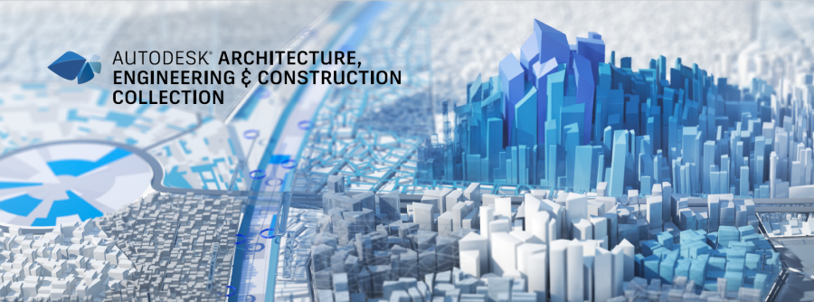
Connected infrastructure design with the Autodesk Architecture Engineering and Construction Collection
Design Consulting Architecture Engineering and Construction Collection logo Moving at the Speed of Business

Connected Infrastructure Design with the Autodesk Architecture Engineering and Construction Collection

Civil engineering projects involve complex designs and planning. For a successful project, the various components of the design and planning process must work together seamlessly. Autodesk’s Architecture Engineering and Construction Industry Collection offers a suite of software tools that allow for connected design in infrastructure projects. The collection integrates different applications, including Civil3D, Revit, Autodesk Docs, and InfraWorks, to enable civil engineers to work collaboratively and efficiently. This blog post will explore how Civil3D works with other applications in the collection, the benefits of connected design for civil engineers, and infrastructure projects.

How Does Civil3D Work With Other Applications in the Collection?

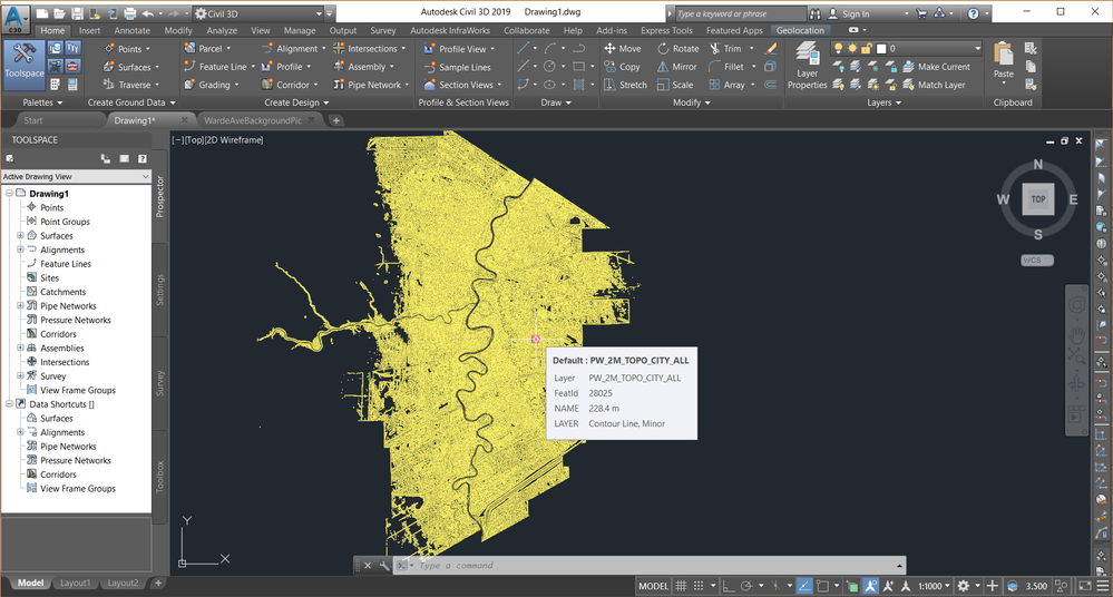
Civil3D is a software tool for civil engineers that helps in the design and analysis of infrastructure projects such as roads, highways, and land development. Civil3D works seamlessly with other applications in the collection to allow for connected design in infrastructure projects.

Revit is a software tool for architects and engineers that allows for the creation of detailed building models. Revit can import Civil3D data, allowing architects to see how buildings interact with the surrounding infrastructure.

Autodesk Docs is a cloud-based document management system that enables teams to collaborate on project documentation in real-time. Civil engineers can use Autodesk Docs to manage project documentation, including design plans, construction schedules, and specifications.

InfraWorks is a software tool that allows for the creation of 3D models of infrastructure projects. Civil engineers can use InfraWorks to visualize the impact of infrastructure projects on the surrounding environment. InfraWorks can also import data from Civil3D, enabling the creation of detailed 3D models of infrastructure projects.

The Benefits of Connected Design for Civil Engineers and Infrastructure Projects

Connected design offers several benefits for civil engineers and infrastructure projects. Let’s explore some of these benefits in more detail.

Improved Collaboration

One of the main benefits of connected design is improved collaboration between engineers and other members of the project team. By using software tools like Civil3D, Revit, Autodesk Docs, and InfraWorks, engineers can work together in real-time to make changes and updates to the model. This collaborative approach can lead to more efficient and effective decision-making, which can ultimately save time and reduce errors in the design process. Connected design also allows for better communication between team members, as everyone has access to the same data and can easily share their ideas and feedback.

Streamlined Design Process Connected design also streamlines the design process for civil engineers. With software tools like Civil3D, engineers can create accurate and detailed 3D models of their designs, which can be easily imported into other applications like Revit and InfraWorks. This integration between different software tools eliminates the need for manual data transfer, which can be time-consuming and error-prone. The streamlined design process also allows for faster iteration and decision-making, as engineers can quickly make changes and updates to the model based on feedback from other team members.

More Accurate and Detailed Modeling

Connected design enables civil engineers to create more accurate and detailed models of their designs. With software tools like Civil3D, engineers can create 3D models that accurately represent the real-world conditions of the project site. This level of detail allows engineers to analyze and test their designs more thoroughly, which can help identify potential issues and prevent costly mistakes during construction. More accurate and detailed modeling also enables engineers to optimize their designs for efficiency, reducing the overall cost and environmental impact of the project.

Better Data Management Connected design also provides better data management for civil engineers. With software tools like Autodesk Docs, engineers can store and manage all project data in one central location. This eliminates the need for manual data transfer and ensures that all team members have access to the most up-to-date information. Better data management also enables engineers to track changes and updates to the design over time, which can be helpful for future maintenance and repairs.

Enhanced Visualisation

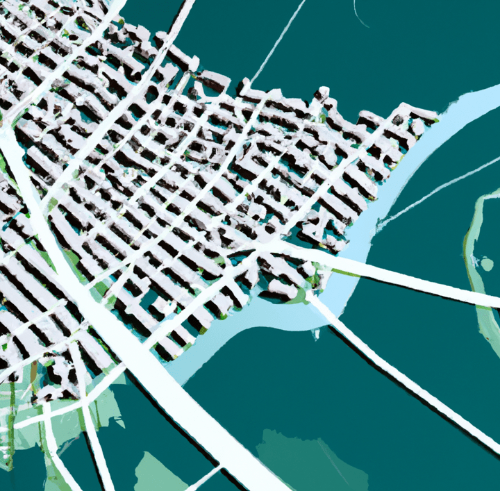
Finally, connected design enables enhanced visualization for civil engineers. With software tools like InfraWorks, engineers can create 3D models of entire cities and infrastructure projects, which can be used to visualize the impact of the project on the surrounding environment. Enhanced visualization can also be helpful for presenting designs to stakeholders and the public, as it provides a clear and detailed representation of the project.

Unlocking the Potential of Connected Civil Engineering Design with Autodesk's AEC Industry Collection

Civil 3D, InfraWorks, and Revit are all part of the Autodesk Architecture, Engineering, and Construction (AEC) industry collection, and are designed to work together for connected design workflows.

InfraWorks is used for creating and visualizing large-scale infrastructure projects, such as roads, highways, and airports. It provides tools for creating 3D models of proposed designs, analyzing the impacts of these designs on the surrounding environment, and sharing and collaborating with other stakeholders.

Civil 3D, on the other hand, is focused on detailed civil engineering design, such as grading, drainage, and road design. It allows for the creation of detailed design models, analysis of earthwork quantities, and the creation of construction documentation.

Revit is a BIM software that provides tools for creating and managing detailed 3D models of buildings and structures. It can be used to create and analyze structural designs, as well as to manage building information throughout the design and construction process.

When used together, these tools enable a connected design workflow that allows for the creation and analysis of both the infrastructure and the buildings and structures that will be integrated into it. InfraWorks can be used to create a preliminary design of the infrastructure project, which can then be imported into Civil 3D for detailed design and analysis. Revit models can also be integrated into the design process, allowing for the creation of detailed building information models that can be analyzed in the context of the surrounding infrastructure.

Overall, the connected design workflow enabled by these tools allows for greater collaboration and efficiency throughout the design and construction process, leading to better outcomes for infrastructure projects.


Ready to Get Connected?

Save up to 20% on Autodesk Software and Services

AutoCAD vs. AutoCAD Civil 3D vs. Revit

AutoCAD is a general-purpose CAD software used for 2D drafting and 3D modeling, whereas Civil 3D is specifically designed for civil engineering tasks such as road design and land development. Revit is a BIM software used for building design and construction documentation. While AutoCAD and Civil 3D are more focused on geometric design, Revit allows for the creation of detailed 3D models with parametric design features. Civil 3D and Revit also offer collaboration features such as cloud-based sharing and real-time updates, which are not available in AutoCAD. The choice between these software depends on the specific needs and tasks of the project.

FeaturesAutoCADCivil 3DRevit
2D DraftingYesNoYes
3D ModelingYesYesYes
Geometric DesignYesYesLimited
Civil Engineering DesignNoYesYes
Road DesignNoYesLimited
Land DevelopmentNoYesLimited
BIM FeaturesNoNoYes
Parametric DesignNoNoYes
Cloud-Based SharingNoYesYes
Real-Time UpdatesNoYesYes
Bridge DesignNoYesYes
TopographyNoYesYes
Civil Structural EngineeringNoYesYes


Civil 3D vs. Infraworks

Civil 3D and InfraWorks are both part of the Autodesk AEC industry collection and are commonly used for civil engineering and infrastructure design projects. While they share some similarities, they have distinct differences in terms of their focus and capabilities.

Civil 3D is primarily focused on detailed design for civil engineering projects, such as grading, drainage, and road design. It is a powerful tool for creating accurate 3D models of proposed designs and analysing earthwork quantities, as well as for creating construction documentation. Civil 3D is ideal for engineers who need precise control over the design process and require a high level of detail and accuracy.

InfraWorks, on the other hand, is focused on conceptual design and visualization for large-scale infrastructure projects, such as highways, airports, and rail networks. It provides tools for creating 3D models of proposed designs, analyzing the impacts of these designs on the surrounding environment, and sharing and collaborating with other stakeholders. InfraWorks is ideal for early-stage design, where the focus is on understanding the potential impacts of a project and communicating that information to stakeholders.

When used together, Civil 3D and InfraWorks enable a connected design workflow that allows for the creation and analysis of both the detailed civil engineering design and the larger-scale infrastructure design. Civil 3D can be used to create detailed design models, which can then be imported into InfraWorks for visualisation and analysis in the context of the surrounding environment. InfraWorks models can also be used to create preliminary designs that can be refined and detailed in Civil 3D.

A feature comparison matrix for Civil 3D and InfraWorks might include the following:

FeatureCivil 3DInfraWorks
Detailed designYesNo (focused on conceptual design)
Earthwork quantitiesYesNo
Terrain modelingYesYes
Analysis toolsYesYes
VisualisationLimited (focused on detailed design)Extensive (focused on conceptual design)
CollaborationLimited (focused on detailed design)Extensive (focused on conceptual design)

Overall, the connected design workflow enabled by Civil 3D and InfraWorks allows for greater collaboration and efficiency throughout the design and construction process, leading to better outcomes for infrastructure projects. Civil 3D is ideal for detailed design, while InfraWorks is ideal for early-stage design and visualisation.

Empowering Civil Engineering Design with Dynamo for Civil 3D: Streamline Workflows and Boost Efficiency

Dynamo for Civil 3D is a powerful tool that allows users to automate complex design tasks and create custom workflows for Civil 3D. Dynamo is a visual programming language that can be used to create custom scripts that automate repetitive design tasks, such as creating road alignments, profiles, and surfaces.

With Dynamo, Civil 3D users can create custom tools and workflows that are tailored to their specific project needs. For example, users can create scripts that automatically generate designs based on predefined parameters, or scripts that analyze and optimize designs for cost and efficiency.

The use of Dynamo for Civil 3D can significantly streamline the design process, reduce errors, and improve project outcomes. By automating repetitive tasks, engineers and designers can focus on higher-level design decisions and creative problem-solving.

Connected Infrastructure Design

The Autodesk Architecture Engineering and Construction Collection is a powerful suite of software programs that can help architects create better designs and collaborate more effectively with other professionals in the construction industry. By using programs such as Revit, Navisworks, and Docs, architects can create digital models of buildings and share them with other stakeholders, streamlining the design process and reducing errors. By collaborating with MEP/HVAC, Structural and Civil engineers and designers, architects can ensure that their designs are not only visually appealing but also practical and functional, resulting in better-performing buildings that meet safety and regulatory requirements.

Ready to get your Design Connected?

Discover how Autodesk Architecture Engineering and Construction Collection can streamline your workflow, increase productivity, and optimise your design process. 

Get up to 20% Off Software or Services!

Contact us to find out how much money you can save on software, training or other services. Fill out the form below, by live chat, phone or email.

P: 1800 490 514 |  E: info@designconsulting.com.au

Connected Design

The Autodesk Architecture, Engineering and Construction Collection streamlines design, analysis, and visualization for architecture, engineering, construction, infrastructure, and manufacturing industries. The suite of software programs improves efficiency, reduces errors and rework, and increases cost-effectiveness.

Connected Design with Architecture Engineering and Construction Collection

Click a link below to learn more about Connected Design using the Autodesk Product Design & Manufacturing Collection 
VIEW MORE

Connected Design with the Autodesk Architecture Engineering and Construction Collection

The Autodesk Architecture, Engineering and Construction Collection streamlines design, analysis, and visualization for architecture, engineering, construction, infrastructure, and manufacturing industries. The suite of software programs improves efficiency, reduces errors and rework, and increases cost-effectiveness.
Design Consulting Architecture Engineering and Construction Collection logo Moving at the Speed of Business

Connected Design with the Autodesk Architecture Engineering and Construction Collection

In today’s fast-paced world, the construction industry is continuously evolving with new technology advancements. As technology advances, it becomes essential to have an efficient and connected design process that incorporates design, analysis, and visualization. The Autodesk Architecture, Engineering and Construction Collection is a comprehensive suite of software programs that facilitate this process. This blog post will discuss how the Autodesk Architecture, Engineering and Construction Collection can benefit various industries by connecting design, analysis, and visualization.

Connected Design Workflow: How Software Programs Work Together

The Autodesk Architecture, Engineering and Construction Collection consists of multiple software programs that allow for a connected design workflow. The software programs in the collection work together seamlessly, allowing for efficient design, analysis, and visualization. The collection includes software programs such as AutoCAD, Revit, Navisworks, and more. Each software program is designed to perform a specific task, and when used together, they create a comprehensive design workflow.

Designing with Precision: AutoCAD and Revit in the AEC Collection

The first step in any construction project is design. The Autodesk Architecture, Engineering and Construction Collection includes various software programs that aid in the design process. AutoCAD is a widely used software program that allows for 2D and 3D drafting. AutoCAD is used to create detailed drawings, and it is compatible with other software programs in the collection. Revit is another software program that is used in the design process. Revit allows for BIM (Building Information Modelling), which helps in creating a detailed 3D model of the building. By using Revit, the design process becomes more efficient, as the software program allows for collaboration between various stakeholders.

Revit and Civil 3D: Enhancing Infrastructure and Construction Projects with 3D Modeling and Efficient Design Collaboration

Revit and Civil 3D are commonly used in the AEC industry for infrastructure and construction projects. Revit creates 3D models of buildings, while Civil 3D designs infrastructure projects. Used together, they complement each other and improve the design process by identifying potential design issues in 3D models. Changes made in one software program are automatically updated in the other. This streamlines the design process and helps identify issues early in the design phase.

Ready to Get Connected?

Save up to 20% on Autodesk Software and Services

How Revit and Advance Steel Work Together to Streamline Steel Design and Fabrication

Revit and Advance Steel are two software programs that can be used together in the architecture, engineering, and construction (AEC) industry. Revit is a building information modeling (BIM) software that is used to create 3D models of buildings, while Advance Steel is a 3D modeling software that is used to design steel structures.

When used together, Revit and Advance Steel can improve the efficiency and accuracy of the design process. For example, an engineer can create a 3D model of a building in Revit and then export it to Advance Steel to design the steel structure. The engineer can then import the steel structure design back into Revit to ensure that it is compatible with the rest of the building design.

In addition, when changes are made in one software program, they are automatically updated in the other software program. This means that any changes made to the steel structure design in Advance Steel will be automatically reflected in the building design in Revit, and vice versa.

Using Revit and Advance Steel together can also help identify potential design issues early in the design phase. The 3D models created in Revit and Advance Steel can be used to identify clashes or conflicts that may have been missed in 2D design drawings. This can help save time and reduce the risk of errors and rework later in the project.

In conclusion, Revit and Advance Steel are powerful software programs that can be used together to improve the efficiency and accuracy of the design process in the AEC industry. The ability to export and import design elements between the two software programs and ensure that changes are automatically updated can streamline the design process and help identify potential issues early in the design phase.

Efficient Analysis with Navisworks and Autodesk Robot Structural Analysis Professional

The Autodesk Architecture, Engineering and Construction Collection includes software programs that aid in the analysis process. Navisworks is a software program that allows for coordination and simulation of construction projects. Navisworks helps in identifying clashes, reducing errors and rework, and creating more efficient designs. Additionally, Autodesk Robot Structural Analysis Professional is used to perform structural analysis of buildings. The software program helps in identifying structural deficiencies and optimizes the design process.

Bringing GIS Mapping and Connected Design Together: A Comprehensive Approach with Autodesk's AEC Collection

In today’s world, design and construction projects require a more comprehensive approach than ever before. With the Architecture Engineering and Construction (AEC) Collection from Autodesk, architects, engineers, and construction professionals have access to a suite of powerful tools that can help them collaborate and work more efficiently. One of the most valuable features of the AEC Collection is its ability to integrate with Geographic Information Systems (GIS) mapping, providing a more accurate and detailed view of project sites and landscapes.

AutoCAD Map 3D is a powerful software tool for GIS mapping, which allows users to access, manage and analyse spatial data. With AutoCAD Map 3D, users can easily import and export data from various sources, such as aerial imagery, satellite imagery, and other GIS data. This software also provides a wide range of tools for data analysis, visualization and editing, making it an essential tool for GIS professionals. Some of the key features of AutoCAD Map 3D include 3D modelling and visualisation, data query and analysis, and advanced geospatial analysis tools. By leveraging these features, users can create accurate and comprehensive maps and spatial data sets for a wide range of applications.

GIS mapping is a critical component of many construction projects, particularly those that involve large-scale developments or infrastructure. By overlaying geographic data such as topography, hydrology, and geology onto a digital map, project teams can better understand the context of their projects and make more informed decisions. The AEC Collection’s integration with GIS mapping tools allows architects, engineers, and construction professionals to access this data within their design software, creating a more seamless and connected workflow.

With the AEC Collection, design professionals can also collaborate with each other in real-time using tools such as Navisworks and Docs. Navisworks allows teams to integrate and coordinate models from multiple disciplines, while Docs enables document management and sharing across teams. By using these tools in conjunction with GIS mapping, project teams can ensure that all stakeholders have access to the most up-to-date information, reducing errors and improving overall project efficiency.

Enhancing Oil and Gas Plant Design with the AEC Collection and Plant 3D

The Architecture Engineering and Construction (AEC) Collection is a powerful suite of software programs designed to facilitate connected design for the architecture industry. One of the key software programs in this collection is Plant 3D, which is specifically designed for oil and gas plant design.

Plant 3D is a comprehensive software program that enables users to design, model, and analyze piping and instrumentation diagrams (P&ID) for oil and gas plants. With its intuitive interface and advanced tools, Plant 3D allows users to create accurate and detailed 3D models of plant layouts, equipment, and piping systems.

One of the key advantages of using the AEC Collection and Plant 3D for oil and gas plant design is the ability to collaborate with other disciplines in the industry, such as civil engineering and structural design. By working together in a connected design environment, designers and engineers can ensure that all aspects of the plant design are integrated seamlessly, from the initial concept through to construction and operation.

In addition, the AEC Collection and Plant 3D offer a range of powerful tools for data management and analysis, enabling users to track and monitor plant performance, optimize plant layouts, and identify potential safety hazards or operational issues.

Some of the key features of Plant 3D include:

  • Intelligent P&ID design and management tools
  • Comprehensive 3D modeling capabilities
  • Advanced piping and instrumentation analysis tools
  • Integration with other AEC Collection software programs, such as Navisworks and Docs

By leveraging these features, designers and engineers in the oil and gas industry can streamline their design processes, improve collaboration, and ensure that their plant designs are optimized for safety, efficiency, and performance.

Enhancing Visualisation with 3DS Max and InfraWorks

Visualisation is an essential part of any construction project. The Autodesk Architecture, Engineering and Construction Collection includes software programs that aid in the visualization process. 3DS Max is a software program that allows for rendering and animation of 3D models. 3DS Max helps in creating realistic visuals, which help in selling designs to clients. Autodesk InfraWorks is another software program that helps in creating visualizations of infrastructure projects. InfraWorks allows for collaboration between various stakeholders, and it helps in creating a more efficient design process.

Streamlining AEC Projects with Autodesk Docs

Autodesk Docs is a powerful document management tool that can help streamline AEC projects when used in conjunction with the Architecture Engineering and Construction Collection (AEC Collection) software. The AEC Collection includes several software programs that are essential for building design and construction, including Revit, Civil 3D, and Advance Steel.

By using Autodesk Docs to manage project documents, stakeholders can easily access and collaborate on project files from anywhere, at any time. This can improve project efficiency and communication, as all team members can stay up-to-date on project progress and changes.

Moreover, the AEC Collection software can be seamlessly integrated with Autodesk Docs, allowing users to store and manage their project files directly within Autodesk Docs. This integration makes it easier for teams to collaborate on project files and ensures that all project documentation is stored in one place, reducing the risk of lost or missing files.

For example, Revit models can be directly linked to Autodesk Docs, allowing team members to access and collaborate on the most up-to-date model at all times. Civil 3D designs can also be stored in Autodesk Docs, making it easy to share and collaborate on complex civil engineering projects.

Overall, by using Autodesk Docs in conjunction with the AEC Collection software, AEC professionals can streamline their project workflows, improve collaboration and communication, and ensure that project documentation is secure and easily accessible.

AEC Collection in Various Industries: Architecture, Engineering, Construction, Infrastructure, and Manufacturing

The Autodesk Architecture, Engineering and Construction Collection is beneficial to various industries. Here are a few examples:

Architecture: The Autodesk Architecture, Engineering and Construction Collection is used by architects to design and visualise buildings. The software programmes in the collection allow for efficient design, analysis, and visualisation.

Engineering: Engineers use the Autodesk Architecture, Engineering and Construction Collection to perform structural analysis and design. The software programmes in the collection help in identifying structural deficiencies, optimising designs, and creating efficient designs.

Construction: The Autodesk Architecture, Engineering and Construction Collection is used in the construction industry to coordinate and simulate construction projects. The software programmes in the collection help in identifying clashes, reducing errors and rework, and creating more efficient designs.

Infrastructure: The Autodesk Architecture, Engineering and Construction Collection is used in the infrastructure industry to design and visualise infrastructure projects. The software programmes in the collection, such as InfraWorks, help in creating visualisations of infrastructure projects. InfraWorks allows for collaboration between various stakeholders, including engineers, designers, and contractors. By using the Autodesk Architecture, Engineering and Construction Collection, infrastructure projects can be completed more efficiently and cost-effectively.

Manufacturing: The Autodesk Architecture, Engineering and Construction Collection is also used in the manufacturing industry. The collection includes software programmes that aid in the design of manufacturing equipment and machinery. Autodesk Inventor, for example, is used to design and test products before they are manufactured, reducing errors and costs.

Architecture Engineering and Construction Collection Connected Design Matrix

SoftwareDescriptionFile TypeCommandImport/ExportLink
AutoCAD2D and 3D computer-aided design software used for creating blueprints, schematics, and modelsDWG, DXF, DWFDRAWING, MODEL, VIEW, PLOTImport: DWG, DXF, DWF, PDF, STEP, SAT, IGES, STLExport: DWG, DXF, DWF, PDF, STL, OBJ, FBX
RevitBuilding information modeling (BIM) software used for creating detailed 3D models of buildings and structuresRVT, RFA, RTEOPEN, VIEW, EXPORT, PRINTImport: DWG, DXF, IFC, SAT, SKP, 3DM, STL, OBJ, FBXExport: DWG, DXF, DWF, PDF, IFC, SAT, SKP, 3DM, STL, OBJ, FBX
Civil 3DCivil engineering design and documentation software used for designing, analyzing, and documenting civil engineering projectsDWGCIVIL3D, C3DImport: DWG, LandXML, RevitExport: DWG, LandXML, Revit
InfraWorksInfrastructure design and engineering software used for creating 3D models of infrastructure projectsIAMOPEN, MODEL, VIEW, EXPORT, PUBLISHImport: DWG, DGN, GIS, SHP, KML, FBXExport: DWG, DGN, FBX, COLLADA, OBJ, IFC, KMZ
3ds Max3D modeling, animation, and rendering software used for creating visualizations of buildings and environmentsMAXOPEN, MODEL, RENDERImport: DWG, FBX, DAE, OBJ, 3DS, STLExport: DWG, FBX, DAE, OBJ, 3DS, STL
NavisworksProject review software used for 3D coordination, model analysis, and clash detectionNWD, NWFOPEN, APPEND, EXPORT, PUBLISHImport: DWG, DWF, DGN, IFC, SKP, FBX, 3DS, OBJExport: DWF, DWFx, NWC, NWF, FBX, 3DS, OBJ
Advance SteelSteel detailing software used for creating structural steel models and fabrication drawingsDWG, DSTVOPEN, MODEL, EXPORTImport: DWG, CIS/2, SDNF, IFC, STEP, SAT, SKPExport: DWG, DSTV, CIS/2, SDNF, IFC, STEP, SAT, SKP
Robot Structural Analysis ProfessionalStructural analysis software used for simulating and analyzing building structuresRST, RSA  

AEC Collection: A Valuable Tool for Cost-Effective Design Processes.

In conclusion, the Autodesk Architecture, Engineering and Construction Collection is a comprehensive suite of software programs that facilitates a connected design workflow. The software programs in the collection work together seamlessly, allowing for efficient design, analysis, and visualization. By using the Autodesk Architecture, Engineering and Construction Collection, various industries can benefit from a more efficient and cost-effective design process. The collection is beneficial to architects, engineers, construction professionals, infrastructure designers, and manufacturers. The collection is continuously evolving to meet the needs of these industries, and it remains a valuable tool in the construction industry.

Ready to get your Design Connected?

Discover how Autodesk Architecture Engineering and Construction Collection can streamline your workflow, increase productivity, and optimise your design process. 

Get up to 20% Off Software or Services!

Contact us to find out how much money you can save on software, training or other services. Fill out the form below, by live chat, phone or email.

P: 1800 490 514 |  E: info@designconsulting.com.au

Connected Design

The Autodesk Architecture, Engineering and Construction Collection streamlines design, analysis, and visualization for architecture, engineering, construction, infrastructure, and manufacturing industries. The suite of software programs improves efficiency, reduces errors and rework, and increases cost-effectiveness.

Connected Design with Architecture Engineering and Construction Collection

Click a link below to learn more about Connected Design using the Autodesk Product Design & Manufacturing Collection 

VIEW MORE

Autodesk Portal Gets New Usage Reporting Features

Autodesk Portal New Usage Reports Side Bar Moving at the Speed of Business

NEW Autodesk Usage Report

Autodesk have announced that there are new usage reporting features within the Autodesk Account Management Portal for Autodesk accounts.

Coming soon, this new reporting tool will be found under Usage Report. Whether your users are on Autodesk subscriptions or Autodesk Flex licenses, you can now view the product usage details for all of your users on one single page with Usage Report. All admins on all Autodesk plans will have access to the new Usage Report.

Have a look in the reporting section of your account. When the new feature is activated, you will see a snapshot of important details for both subscriptions and Flex. The information available in the new reporting tool ncludes:

  • Total number of Autodesk subscriptions for your team(s)
  • The number of active or inactive users
  • The number of Flex tokens used and Flex tokens remaining
  • The monthly average Flex token usage

You now have easy access to all of this data at your fingertips with a single report showing usage across both Autodesk Flex and Autodesk Subscriptions.

Autodesk Portal New Usage Reports Moving at the Speed of Business

As you scroll down the report you will see a list of users with simple summaries showing:

  • Which Autodesk products they’re using
  • The average number of days they use each product per month
  • How many Flex tokens they’ve used.

You can use the report to differentiate between frequent and infrequent users to adjust and optimize licenses for your team.  For example, you can identify light users and assign them Flex licenses.

Clicking on a user, you can drill down for more detailed information on that particular user as shown below:

Autodesk Portal New Usage Reports User Moving at the Speed of Business

Additionally, you can use filters to arrange your data and identify specific information of interest. For example, you can filter by products, teams or access type. Any filters you apply will also be carried over to the export functionality if you choose to export your data for additional analysis and insights outside of Usage Report, in Microsoft Excel or a Google Sheet for example.

Autodesk Portal New Usage Reports Filter Moving at the Speed of Business

The new Usage Report provides a single view of how all of your Autodesk users are using their licenses. The new Usage Report will help you identify patterns and make better decisions.  For example, the new Usage Report can help you decide:

  • Which users might benefit from using Flex or subscription
  • When to buy more subscriptions or tokens,
  • Which inactive subscriptions you can reassign

Coming Soon

This new reporting feature is not available yet.  When it is launched, you will find it in the Reporting menu as shown below:

Autodesk Portal New Usage Reports Side Bar Moving at the Speed of Business

More Information

Contact us  on 1800 490 514, info@designconsulting.com.au, by live chat or fill out the form below to get more information on how to best manage your Autodesk licenses and tokens.  Our team of experts have saved our clients thousands of dollars by helping them make smart decisions around how to best structure their investment in technology for maximum return on investment.   We’d be happy to audit your existing license structure and recommend any changes that you could benefit from.


Contact Form Demo

VIEW MORE

Sharing Civil 3D Surfaces with Revit using Autodesk Docs

Civil 3D Surface Model

Autodesk Docs can now be used as a conduit for sharing Civil 3D surface models with Revit. In the past, it’s been surface sharing has been challenging, but now, when you share surfaces through Autodesk Docs, they retain the triangulation found in Aurdoesk Civil 3D and they are much easier to update.  If a new shared surface is modified in Civil 3D, a new version can be published to DOcs and then refreshed in Revit.

In the video below, civil industry expert Jeff Bartels explains how you can make the connection between the two platforms.  The video also explores how the Shared Reference Point feature can be used to align the Civil 3D and Revit environments.

See the video below to learn more.

Discover the Architecture, Engineering and Construction Collection.

Get access to both Civil 3D, Revit and much more in the Architecture, Engineering and Construction Collection.  Get all the software you need to create seamless workflows and collaborate with ease.

Get Your Free Consultation

Contact us  on 1800 490 514, info@designconsulting.com.au, by live chat or fill out the form below to book in a free consultation. We have a team of experts ready to help you create efficient workflows in your organisation.


Contact Form Demo

VIEW MORE

Twinmotion Now In Revit And AEC Collection

Twinmotion
Twinmotion

Exciting news!  Twinmotion is now officially included with Autodesk Revit subscriptions!

Announced at Autodesk University in September, it’s finally here!  Autodesk have collaborated with Epic Games to include Twinmotion with all Revit subscriptions. Whether you subscribe to the AEC Collection or standalone Revit, use Flex pricing or have an education license, you now have at your fingertips the real-time visualisation power of Twinmotion for Revit.

Twinmotion’s real-time rendering capabilities enable architectural storytelling through real-time visualisation.

With Twinmotion for Revit, Revit users can now easily bring their designs to life with high-quality visualisations in a fast, interactive creative process. Everything from photorealistic stills and animations to compelling immersive VR is all now possible. 

Launch Twinmotion for Revit directly from the Revit ribbon in Revit 2023.1. Immerse yourself in the intuitive creator environment, turning your design data into photo-realistic stills, scenes, and scenarios. Present a powerful picture of how your design is working, making it easier to evaluate options, make decisions and take clients and stakeholders through impressive experiences that  add shine and sophistication to your design communications. You can then utiilise your impressive content to win more work!

From project stills and animations, to VR experiences: Autodesk and Epic Games have now introduced powerful new tools into Revit that showcase your creativity, illuminate your insights, and help you better connect digital and physical worlds.

Get Twinmotion For Revit

Contact us  on 1800 490 514, info@designconsulting.com.au, by live chat or fill out the form below to get Twinmotion for Revit today.


Contact Form Demo

VIEW MORE

What’s New in Civil 3D 2022

Autodesk Civil 3D grading optimisation. AutoCAD vs Civil 3D

What's New in Autodesk Civil 3D 2022

The Autodesk Civil 3D 2022 release brings new alignment and ArcGIS workflows, enhancements with pressure networks and for AEC Collection subscribers, new functionality to the Project Explorer. 

Alignment Workflows

The better handle complex geometry for ramps and interchanges, there has been new enhancements to connected alignment functionality:

  • Curve group combinations
    • Free Reverse Spiral-Curve-Spiral-Spiral (From entity, end curve)
    • Free Reverse Spiral-Spiral-Curve-Spiral (From curve, end entity)
    • Free Reverse Spiral-Spiral-Curve-Spiral-Spiral (Between two curves)
  • Curves grater than 180 degrees
  • Connected alignments can now be created at offsets from parent alignments to support slip lane and off-ramp scenarios.
  • A preview option to view before executing the command

Pressure Networks

  • The color and diameter of the compass can now be specified using options on the ribbon when laying out a path-based pressure network.
  • The Profile Layout ribbon tab has been updated for path based pressure networks to make it more consistent with the plan layout ribbon.
  • Spanning labels for pressure networks can now be created in plan and profile views.
  • PVIs can now be removed from overridden station ranges of pressure network in profile view that are set to static (non-dynamic) state. When selected, the Clean Up PVIs check box on the Pipe Run Profile Settings dialog box removes PVIs from overridden station ranges. You can use the Apply button to preview the changes in the drawing.
  • A command named RegenPressureSolid was added to regenerate 3D solids for pressure network parts.

ArcGIS

  • Raster data imported from ArcGIS can now be refreshed from ArcGIS. For more information, see To Refresh Data from ArcGIS.
  • When importing and refreshing raster data, users can configure the resolution for each raster layer separately.
  • The number of available resolution levels has been extended for importing ArcGIS raster data  from 19 levels to 23 levels.

User Profile

Users can create their own custom profile based on information about their disciplines and job roles.

Project Explorer

  • Support has been added for pressure networks in Project Explorer:
    • Added support for displaying and editing pressure network information, such as name and style.
    • Added support for displaying dynamic profile views for pressure pipe runs in the Project Explorer window.
    • Added support for editing multiple pressure network properties and pressure part properties.
    • Added support for editing the layout and view style of pressure networks and pressure parts.
    • Added Object Set support for pressure networks and pressure parts.
    • Added support for generating reports for pressure networks, pressure parts, and pressure pipe runs.
    • Added support for generating AutoCAD tables for pressure networks, pressure parts and pressure pipe runs.
    • Added support for comparing pressure pipe run sample points with other surfaces.
    • Added support for searching for pressure networks by name.
  • Support has been added for feature lines in the <None> site (siteless feature lines).
  • Project Explorer is now launched from the Home tab of the Civil 3D ribbon.
  • Project Explorer is now available in all languages currently supported by Civil 3D. The assigned language for Project Explorer is determined by the regional language settings in Windows.

Grading Optimisation

For AEC Collection users, Civil 3D now includes Grading Optimisation which works as a preliminary terrain optimisation tool for site designers. It uses design data and automates otherwise repetitive manual grading tasks according to customized object constraints.

Available objects include:
  • zones
  • drain lines
  • low points
  • building pads and reveals
  • curbs
  • sidewalks
  • paths
  • parking lots
  • ponds

Once these objects are defined with their project relate constraints, Grading Optimization delivers an optimized terrain surface and 3D geometry back into the design tool for further detailed design.

Contact Us

If you would to discuss Autodesk software, please contact us by calling on 1800 490 514, by filling out the form or clicking the live chat in the bottom right-hand corner.

VIEW MORE